mammoth // building nothing out of something

mud and oil

river road
[image: Gena Wirth]

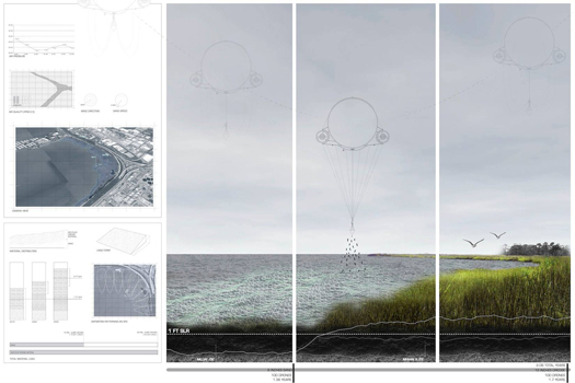
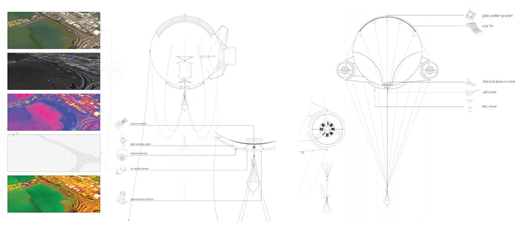
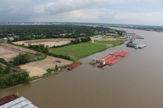
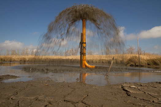
If you’ll be in New Orleans next week for the ASLA convention, you can join SCAPE Studio and the Dredge Research Collaborative for a bus tour of petrochemical and sedimentary infrastructure along River Road. In addition to SCAPE and the DRC, you’ll have the opportunity to hear from local experts including Scott Eustis (coastal wetlands specialist at the Gulf Restoration Network and, among other things, Public Lab kite flyer), Michael Orr (Communications Director at the Louisiana Environmental Action Network), and Randy Petersen (a Louisiana petrochemical industry expert at Homesite Company and author of “Giants on the River”, a history of the petrochemical industry along River Road).

You can sign up through the ASLA’s website, where you’ll be looking to register for FS-008.

dredgefest california

Print

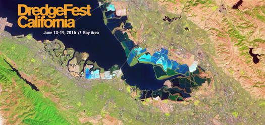
The Dredge Research Collaborative is inviting participants to apply for the workshops at our upcoming event, DredgeFest California.

We are seeking faculty, practicing designers, scientists, industry professionals, policymakers, regulators, junior scholars, advanced students, and other interested parties to join us in the Bay Area, June 13-19, 2016.

DSC_2607

DSC_2640
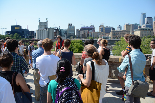
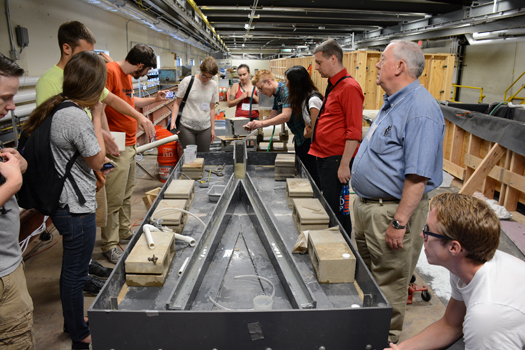
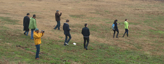
[Tours at DredgeFest Great Lakes, summer 2015.]

Sediment is critical to the present and future health of California’s estuarine Bay-Delta. It is the physical infrastructure that underlies its many ecologies and economies. As the 2015 State of the Estuary report notes, “Like fresh water, sediment is a precious resource that is essential for keeping the Estuary healthy”.

But the Bay-Delta currently has a shortage of this land making resource. Upriver dams have trapped sediment, while levees, bank armoring, and river straightening have cut off wetlands and floodplains while accelerating the movement of the remaining sediment, preventing it from building substrate. The Bay’s coastal wetlands, which are critical to sea-level rise adaptation, face an unprecedented deficit of sediment. Some of the Delta’s levees are now protecting “islands” so deeply subsided that they are much lower than adjacent waterways, stressing the levees — and with them local communities, ecologies, and the role of the Delta as conduit for southern California’s water supply. Sediment, including dredged material, is the primary material available to meet these challenges.

The workshop teams at DredgeFest California will collaborate to produce innovative design and landscape planning that will advance strategies for where that sediment can come from, how it can be delivered, and how it should be placed.

Print_LakeErie
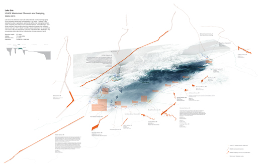
[Dredged navigational channels on Lake Erie; drawing by the Dredge Research Collaborative.]

The workshops will be divided into three tracks:

Bay Sediments
The Bay team will focus on design scenarios for bay and coastal management of sediment in the context of adaptation to accelerated sea-level rise, wetland restoration, maritime economies, the cultural landscape heritage of the Bay, and public waterfront access. It will demonstrate that sediment projects have the potential to not only satisfy immediate economic needs, like the provision of navigation through channel dredging, but also to create additional long-term value for the cultural, ecological, and economic contexts that they are embedded in.

Delta Earthworks
This team will propose innovate strategies for future earthworks and infrastructural retrofits in the Delta, informed by a set of scenarios described and spatially modeled by members of the Dredge Research Collaborative. Proposals will respond to the myriad uncertainties facing the Delta’s infrastructure, including water exports, climate change, regional urbanization, rapid ecological change, potentially disastrous earthquakes, and flood protection needs.

Regional Choreography
The choreography team will construct a set of scenarios that probe potential relationships between sediment sources and sediment deficits across the entire estuary watershed, while considering the potential effects of external drivers such as shifting regional weather patterns, long-term technological innovation, and state and national policy climates. Its work will both be informed by the Bay and Delta tracks and provide broader context for them.

Each track will work as a single multi-disciplinary team, facilitated by the DRC and augmented by lectures, discussions, and critiques with local and regional experts.

The (very brief) applications are due March 1, 2015. More details here.

prosthetic landscapes in a time of acceleration

pl_ci
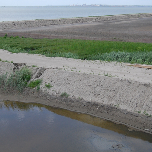
[Levee between two containment cells on Craney Island, summer 2013.]

I’m speaking this Saturday, 28 Feb, at an interdisciplinary arts event in Amsterdam, the Sonic Acts Festival, whose theme for 2015 is “The Geologic Imagination”.

My talk is in a session that starts at 10:30 am, entitled “Landscape Transformation”. The session also includes geologist and author Michael Welland (whose book, Sand, was an early influence on our work in the Dredge Research Collaborative) and film-maker/photographer Jananne Al-Ani (who will be presenting work related to the development of flight and aerial representation — also of great interest here).

I’ll be talking about what I’m calling the “prosthetic littoral”:

The tools are both prosaic and bizarre. Sensate geotextiles. Miniscule tracking sensors embedded in flowing streams of silt and sand. Turbidity curtains. Slumping geotubes. Confined disposal facilities, slowly-shifting landscape machines that occupy entire islands. The polypropylene apparatus of engineered erosion control. Flotillas of suction dredgers. Concrete tetrapods, armoring countless kilometers of coastline.

With such instruments, humans are radically reshaping the pedosphere, the thin skin of active soils that covers the earth. These landscape prosthetics alternately speed up and slow down the movement of sediments, producing an anthropogenic counterpart to familiar natural cycles like the rock and water cycles: the dredge cycle. Within this cyclic whirlwind of accelerated erosion and forced uplift, strange new landscapes are formed and reformed at ever faster pace. Roving the coasts of North America from New York to Virginia to Louisiana, this talk is a tour of such landscapes, the instruments that shape them, and the unexpected design opportunities that may lie within them.

The event is much bigger than just our participation, as it also includes a range of talks from speakers like Liam Young, Smudge Studio, and Benjamin Bratton, music, art installations, and much more. If you’re not in Amsterdam, there is a livestream for the conference.

Excavations, Shockwaves, and Limits

At the end of September, I spoke at an event organized by The Architectural League and co-sponsored by The Cooper Union Institute for Sustainable Design, “The Five Thousand Pound Life: Land”. The Architectural League has recently posted video from the event, so you can now watch the many presentations and discussions; I particularly recommend Jesse LeCavalier’s dissection of UPS’s advertising slogan “Logistics makes the world”, Eric Sanderson and Ted Steinberg on New York City’s natural history and development (Steinberg’s image of the “1914 plan to redeem 50 square miles in New York harbor” is amazing), Albert Pope’s discussion of urban morphologies (which concludes by “reimagin[ing] the Fifth Ward in Houston as a dense, carbon neutral neighborhood”), and Charles Waldheim’s meditation on the disciplinary history of landscape architecture (of particular interest to readers of my previous post on “landscape science”). My own presentation is embedded below. You can also watch the panel discussion that followed with LeCavalier, Alex Klatskin, and moderator Coral Davenport.

Urban Omnibus has a longer recap of the full event.

This presentation drew on work that I’ve been doing both with the Dredge Research Collaborative (Stephen Becker, Brian Davis, Tim Maly, Brett Milligan, and Gena Wirth) and Casey Lance Brown (P-REX); in particular, a talk that Brian, Brett, and I worked on for last summer’s EDRA45 conference, entitled “The Engineering Shockwave of the Panama Canal Expansion”. (If you pay close attention to the credits on the slides, you’ll see that some of the drawings shown in the presentation belong to several of those collaborators.)

on landscape science

Places Journal (newly independent of Design Observer) recently published an argument by Brian Davis and Thomas Oles that landscape architecture should be renamed landscape science:

“Slowly — fitfully — landscape architecture is remaking itself. Its adherents are venturing from the confines of garden, park, and plaza into strange and difficult territory, where they face challenges of a greater order. How will our cities adapt to rising seas? How do we respond to the mass extinction of our fellow species? How can we build places that are more just? Such questions mock the very notion of disciplinary boundaries…

Say it again: landscape architecture. The words roll off the tongue as if their union were inevitable. But this is an arranged marriage…

We need a term that updates Olmsted’s strategy of professionalization for the modern age. A term that is both broader and more specific, a term that can help simultaneously expand and focus the field. And for that there is only one real candidate. We therefore propose that landscape architecture become landscape science.”

This is ridiculously interesting and important.

I agree that there is a shift in both the scope and methodology of landscape research and practice underway. (That might actually be the central concern of this blog.) Consequently, I think it is valuable to attempt to recognize that shift by naming and defining it. (The need for this shift is probably evident to any landscape architect of this emerging sensibility who has tried to explain their work to friends, colleagues, and family members who are not familiar with current trends in the discipline.) In the spirit of contributing to the effort to concretize that shift, then, I’ve named below three primary concerns that I have with the selection of landscape science as worked out by Davis and Oles. Two of this concerns deal with the selection of the term science, while the third (the middle one, by order presented) questions what the relationship between landscape architecture and landscape science is in their proposal, and what it should be.

1 One of the most problematic components of the way that science is treated is its claim to objectivity; to be value-neutral. (We know from the philosophy of science that this is not entirely accurate; but it is perceived to be accurate.) Whereas one of the strengths of landscape architecture relative to other disciplines that make landscapes (logistics, engineering) is precisely that it has practices for making explicit, interrogating, and evaluating values.

1.
I am wary of elevating science in this fashion. This is often a rhetorical move that serves to marginalize other ways of knowing. This is potentially particularly problematic because science often equals “Western science”, and is consequently accompanied by the marginalization of non-Western ways of knowing. (See: scientism, positivism1.)

I know that Davis and Oles have anticipated this objection: “Now we have opened a world of problems, not least that the word science brings its own conflicting associations… This has crowded out the original, more exciting definition.”

I’m not sure, though, that the likely effect of this (re)formulation of landscape science is to restore this earlier formulation of science, generally. It seems far more likely to me that the collective weight of the perception of “scientific inquiry as the cold pursuit of quantifiable phenomena and material effects” will define how landscape science is perceived than the opposite. (And, indeed, to some degree the argument hinges on this: that landscape will gain some of the prestige that is accorded to sciences, precisely because they are perceived in this fashion.)

It seems problematic that the argument hinges on shifting the understanding of a concept back to 19th century terms; how often does this happen? Moreover, how often does it happen when the lever is the self-conception of a relatively small discipline like landscape architecture?

2.
Quoting Davis and Oles:

“Perhaps practitioners of a certain temperament will hold fast to the title of landscape architect, and that specific tradition might be understood as one important pillar in an expanding field of landscape science. People who study landscape science might be known as landscape architects, but also landscape geographers, landscape engineers, and landscape anthropologists (just as they have already started to claim titles such as landscape ecologist, landscape archaeologist, and landscape urbanist), or they might call themselves, more generally, landscape scientists.”

There’s something rhetorically problematic happening here. Should landscape ecology be seen as a subset of landscape architecture? I think not, though the fields are clearly related, both historically, methodologically, and topically; and I doubt that Davis and Oles think so, either. But if not, is the argument here perhaps really for a new umbrella that includes landscape architecture, but isn’t a renaming of it?

2 It seems worthwhile here to also say: I am strongly in favor of Alan Jacobs’ argument for (among other things) “self-consciously distinctive missions” and “pockets of resistance”, which seems potentially applicable to an effort the answer these questions. (Unfortunately, I think that an effort to claim science might radically undermine an effort to be such a pocket of resistance, because of the concerns I outlined in my first point.)

And if so: is that umbrella really a discipline? Or is a mode of operation? A shifting set of tactical alliances between fields that share interests, methodologies, and terrain? Something closer to transdisciplinarity than to a new discipline? If so, are we left in the same place that we started: needing a way to describe the operations (scope, methodology) of the set of researchers and practitioners that Davis and Oles mention (and others who have similar approaches)? Are we saying effectively that these people — as opposed to, say, the practitioners of landscape architecture who are primarily garden designers, or the plaza-makers who are outside architects — are the only ones who are landscape scientists? If so, why not generate another splinter discipline like landscape urbanism: between multiple disciplines, adopted by some practitioners, but not attempting to rename the whole discipline of landscape architecture? Isn’t this a more modest and practicable goal?2

3 Moreover: to return to my first contention, I think it is precisely the quality of landscape architecture as making that positions the discipline as a useful alternative and/or augment (depending on the specifics of place and situation) to more positivistic ways of constructing landscapes, including engineering and logistics.

I find myself continually returning to Dan Hill’s formulation about the value of design in Dark Matter and Trojan Horses:

“the idea that policy and governance can be convincing through mere presentation of fact supported by clear analysis is also being directly challenged. In-depth analytical approaches can no longer stretch across these interconnected and bound-less problems, where synthesis is perhaps more relevant than analysis.

‘The problem is that transparent, unmediated, undisputable facts have recently become rarer and rarer. To provide complete undisputable proof has become a rather messy, pesky, risky business.

Design produces proof, yet as ‘cultural invention’ it is also comfortable with ambiguity, subjectivity, and the qualitative as much as the quantitative. Design is also oriented towards a course of action — it researches and produces systems that can learn from failure, but always with intent. In strategic design, synthesis suggests resolving into a course of action, whereas analysis suggests a presentation of data. Analysis tells you how things are, at least in theory, whereas synthesis suggests how things could be.”

“[design’s] core value… is addressing genuinely meaningful, genuinely knotty problems by convincingly articulating and delivering alternative ways of being”.

This also raises the point that “design” is perhaps being unhelpfully marginalized.

4 I think Davis and Oles acknowledge this, or at least are attempting to acknowledge it (I don’t think they explicitly say they are, so I may be misinterpreting), with the description of “what might its practitioners be called”? But the argument initially hinged on looking at the examples of radical practitioners, and whatever landscape architecture might be or might not be, certainly one of its strengths is that it is a practice. Renaming it in a way that requires a separate new term for the practice of it seems… inadequate. Which leads back to my second contention, about the proposed relationship between landscape architecture and landscape science.

5 This also refers to a point that geologist Brian Romans made in reply to Brian Davis on twitter: that geomorphology might be the most fundamental of all landscape sciences.

It seems there are three possibilities inherent in a formulation of a landscape science: first, that landscape architecture becomes landscape science; second, that landscape architecture (as a whole) becomes a component of a new, broader discipline known as landscape science; third, that some components of landscape architecture (and other disciplines!) enter into a new set of alliances and develop a new set of practices-between-disciplines that might collectively be referred to as landscape science. It seems to me that the first is what Davis and Oles claim to be arguing for (“we therefore propose that landscape architecture become landscape science”), but the last is what they are describing. (Not that I find that problematic! I actually find the last of these options most promising and most exciting.)

3.
My final objection concerns the centrality of making to landscape architecture. Recall the definition of science that Davis and Oles claim:

“a branch of knowledge or study dealing with a body of facts or truths systematically arranged and showing the operation of general laws; knowledge gained by systematic study.”

Science, even defined in this earlier way that does not make exclusive reference to the natural sciences or to the scientific method as a mode of knowledge production, is nonetheless an enterprise focused on knowing. By contrast, landscape architecture is, at least in my opinion, not only a profession of making, but also a discipline whose core depends on making. While making and knowing should not be perceived as being purely exclusive (in fact, I would argue that making can be a way of knowing — this is central to the notion of design as research), their overlap is far from entire. And the practitioners that landscape science would claim (Orff, Cowles, Bargmann, to use Davis and Oles three examples) are clearly makers.

In the middle of their argument, Davis and Oles recommend that:

“…we should establish our own integrated science, with its own specific methods, concepts, and techniques. We can adapt tools from the many fields that already work with landscape as a primary object of inquiry, including archaeology, ecology, environmental studies, history, planning, psychology and sociology.”

But which of those methods does landscape architecture contribute to landscape science? It seems to me that one of the most obvious answers is: landscape architecture, unlike archaeology, ecology, environmental studies, history, psychology and sociology (I leave out planning, whose operations are more ambiguous and variable), makes, builds, fights matter battles. If making is so essential to landscape architecture that it might be the discipline’s primary contribution to landscape science, then is it inadequate to choose a new name that does not acknowledge this3?

I’m not sure that Davis and Oles further definition of landscape science as a normative science (“[according to Peirce], normative science ‘distinguishes what ought to be from what ought not to be‘”) answers this objection. There’s a significant gap between ought and make4. (Do we really think that a maintenance worker is a landscape scientist? This seems to stretch the term terribly far.) Of course, we have a term for someone who applies science to make: a technician. Landscape technics is an interesting alternative, not far removed from Patrick Geddes and Benton MacKaye’s geotechnics5.

Perhaps the greatest disadvantage of technics is that the word is out of fashion, in much the same sense that science is in fashion.

4.
Having detailed these three concerns, it would be right of me to also list the things that I appreciate, because there is a great deal that I appreciate in Davis and Oles’ argument. I don’t know that it is necessary for me to go on in such detail about them, though, so I will simply say: that the array of benefits listed under section III is extremely desirable; that I agree that there is a great deal to be gained by not “privileging… architectural terms and concepts over those of soil science, anthropology, and civil engineering”; and that I agree that there should be an increased focus on experimentation and testing within landscape architecture (I’ve been arguing that for years).

I hope this discussion continues.

sea ice small multiples

nasa_sea-ice
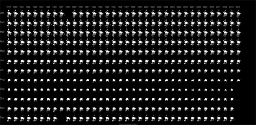
[Small multiples of the extent of North Pole sea ice, 1979-2014; via NASA’s Scientific Visualization Studio.]

the dredge underground

OLYMPUS DIGITAL CAMERA

OLYMPUS DIGITAL CAMERA
[The DredgeFest Louisiana tour enters the Morganza Spillway; I am pretty sure that Tim took these pictures.]

In the recent August issue of Landscape Architecture Magazine, Jennifer Reut wrote a generous profile of the Dredge Research Collaborative and DredgeFest:

It seems almost inevitable, after two successful DredgeFests and several massive coastal floods, that this group of people would have gravitated to this subject at this moment in time. The practice of dredging the coastal waters and rivers in the United States has reached a critical moment. Anxieties about sea-level rise and vulnerable coastlines as well as those from the pressures of a globalized economy on U.S. shipping and transportation sectors can be tied back to dredging. It’s a kind of covert force with impacts that hopscotch across national, geographic, and cultural borders. Five years in, the DRC can now talk with great agility about dredging in a variety of local and global contexts—particularly about the ways in which the practice of dredging rivers and coasts has consequences that can seemingly be solved only by more dredging. This is what the DRC has termed “the dredge cycle”, and discovering how it works in different places is a large part of why DredgeFest exists.

Reut’s article, “The Dredge Underground”, is now available in full for download at Landscape Architecture‘s website.

[Two DredgeFests so far; two more are in differing stages of planning, with DredgeFest Great Lakes up next in Minnesota in August 2015. You can subscribe to a newsletter here that will keep you updated on planning for DredgeFest Great Lakes.]

the five thousand pound life: land

arch5kl_panama canal
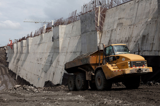
[Hauling earth during the expansion of the Panama Canal; AP Photo]

A quick and rather late notice, of particular relevance to readers in NYC: I’ll be on a panel this Friday, September 26, for The Five Thousand Pound Life’s “Land” symposium, which is co-sponsored by the Architectural League of New York and the Cooper Union Institute for Sustainable Design.

[“Land”] addresses the need to consider settlement patterns and  competing land uses in new ways given the reality of climate change. The value assigned to various forms of land use, and various attitudes  towards land as a resource, must be understood in terms of ecological services and impacts, rather than narrowly-defined economic imperatives.

In sessions on “Nature and the City,” “Spatial Logistics,” and “Density,” speakers will consider American approaches to development, attitudes toward nature, and whether the current dominant narrative of the environmental superiority of concentrated high density development might be challenged by a counter-narrative of lower density land-use that takes advantage of distributed energy production and localized treatment of waste.

There are some great participants including Rebecca Solnit, Charles Waldheim, Eric Sanderson, Jesse LeCavalier, and more.

I’ll be a part of “Spatial Logistics”, talking about the expansion of the Panama Canal, dredging (Mud Dump Site!), and the limits of logistics.

The symposium will be in the afternoon (2:00-6:30 pm) in the Great Hall of the Cooper Union (7 East 7th Street). Tickets are free for students and members of the Architectural League; non-members will need to pay $20. Click here for more details.

suburban futures

At Next City, Amanda Kolson Hurley reports on two examples of contemporary suburban growth, Montgomery County in Maryland and the York region of Ontario, and ties those two examples into broader questions regarding the future viability of suburbanism:

Dead malls. Zombie subdivisions. Metastasizing sprawl. Not a horror movie, but the suburbs circa 2014, or at least the media version of them. We’ve all seen the “suburban wasteland” photos from the Great Recession, the parched streets out West, foreclosure signs swinging in their yards. We’ve read about The End of the Suburbs. No wonder the young and the affluent have flocked back to cities: Suburbia’s demise seems imminent, and assured.

Except that it’s not. More than half of Americans live in suburbs, and about 75 percent of postwar construction has happened in the suburbs. That is a lot of people, and a lot of built environment, for urbanists to just wish away. One hundred and fifty million or so suburbanites have to live somewhere, and preferably not too far from their places of work, which are mostly in the ’burbs, too: More than three-quarters of jobs in U.S. metropolitan areas are located outside the urban core, and 43 percent are at least 10 miles away. (City living doesn’t look like such an environmental slam-dunk when you consider the number of jobs that require a long commute from downtown.) In Canada, two-thirds of the population lives in suburbs, according to a new study, and five times as many people are settling on the edges of major cities as they are in their cores.

Read the full article at Next City.

pilot projects

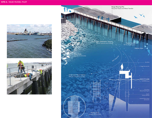
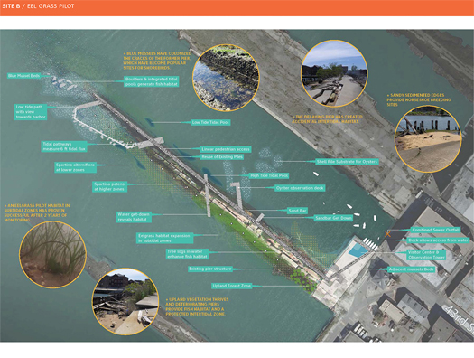
In an article for the recently-launched ARPA Journal, Kate Orff describes a pair of SCAPE pilot projects in New York Harbor, both testing the viability of ecological design concepts for specific harbor-dwelling species along the edge of Brooklyn’s industrial waterfront.

scape_pp_1
[The blue mussel pilot project; image by SCAPE via ARPA Journal.]

The first, located near the outlet of the Gowanus Canal, adapts “fuzzy rope”, a simple material already utilized in aquaculture, to form a set of thirteen panels that retrofit a working pier as blue mussel habitat and, crucially, provide an opportunity to study the effectiveness of various retrofit possibilities in mussel recruitment.

scape_pp_2
[The Eel Grass pilot project; image by SCAPE via ARPA Journal.]

The second, sited slightly further south along the Brooklyn waterfront, builds on a collapsed concrete pier which has “accidentally created intertidal habitat” and an eal grass pilot plot to propose a “deconstructed salt marsh”, which would both incorporate additional pilot plots for a range of typical salt marsh species and serve as a “learning landscape” for the local community.

One of the exciting things about both of these projects is the emphasis on testing, monitoring, and obtaining reliable feedback. In an essay adapted from the introductory chapter of their recent edited collection Projective Ecologies, Nina-Marie Lister and Chris Reed discuss the potential convergence of strains of ecological thought they identify in three divergent domains, natural sciences, the humanities, and design:

…few designers have yet ventured beyond the metaphors and mechanics supplied by these ecological models to design effectively for adaptation to change, or to incorporate learned feedback into the designs, or to work in transdisciplinary modes of practice that open new apertures for the exploration of new systems, synergies and wholly collaborative work. This is the project ahead: leading the sciences, humanities, and design culture toward a more rigorous, robust and relevant engagement across the domains of ecology and design.

For that effort to be successful, more pilot projects will be needed.

[Previously on mammoth: experimental landscape architecture.]

landmarks

odell_landmarks_2

odell_landmarks_3

[Two images from artist Jenny Odell’s series Landmarks, which traces “inadvertent monuments” produced by remote infrastructural operations, such as the Athabasca Oil Sands (top) and a network of “unknown detonation sites” (above) at the Nevada Test Site. The images can be seen in larger and much larger versions on Odell’s website.]

territorial reclamation

spratly_1
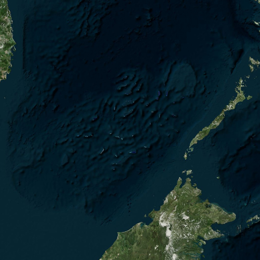
[The Spratly Islands]

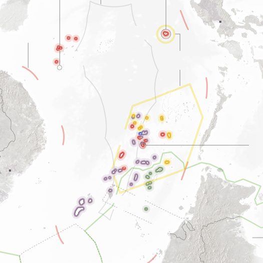
A series of reports from the Philippine government recently emerged and came to the attention of the international press, describing a series of semi-clandestine island-building operations undertaken by the Chinese government in the South China Sea. (To quote a local fishing contractor who works in the vicinity: “there was this huge Chinese ship sucking sand and rocks from one end of the ocean and blasting it to the other side using a tube”.) These acts of territorial reclamation are being undertaken with the intent of enforcing Chinese claims to the vigorously disputed — and likely resource-rich — waters in and around the set of low-lying islands, reefs, and atolls known internationally as the Spratly Islands, as the New York Times reports:

Defense Secretary Chuck Hagel scolded China for “land reclamation activities at multiple locations” in the South China Sea at a contentious security conference in Singapore in late May.

Critics say the islands will allow China to install better surveillance technology and resupply stations for government vessels. Some analysts say the Chinese military is eyeing a perch in the Spratlys as part of a long-term strategy of power projection across the Western Pacific.

Perhaps just as important, the new islands could allow China to claim it has an exclusive economic zone within 200 nautical miles of each island, which is defined in the United Nations Convention on the Law of the Sea. The Philippines has argued at an international tribunal that China occupies only rocks and reefs and not true islands that qualify for economic zones.

“By creating the appearance of an island, China may be seeking to strengthen the merits of its claims,” said M. Taylor Fravel, a political scientist at the Massachusetts Institute of Technology.

spratly_2
[A portion of a map of competing territorial claims in the South China Sea produced by Derek Watkins for the New York Times; view the full map here.]

Maasvlakte 2
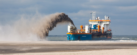
[The Utrecht, one of Dutch dredging conglomerate Van Oord’s fleet.]

1 Take Parag Khanna’s argument here about cities, and rewrite it instead with transnational corporations as its primary actors.

Take as background both this example of the aggressive assertion of territorial influence by a nation-state through dredging and the general anticipation of the increasing economic importance of seabed mining, offshore drilling, and other economic exploitations of oceanic territories. It is not difficult to envision dredge developed as a new frontier in international conflict, where oceanic international borders are rapidly re-shaped by the construction and counter-construction of island chains and atoll formations, all strategically deployed to extend and compress bands of territorial waters, in a game of Go played by foreign ministers releasing escalating and conflicting bids to dredging contractors. (China offers Boskalis $600 million; Vietnam counters with $700; the Philippines derails their bid at the last minute with a promise of a cut of oil rights for the corporation, prompting China and Vietnam to covertly deploy a fleet of pirate dredgers, who siphon sand from the new Filipino island at night.)

Or, speaking of those dredging contractors, given the enormous role of corporations in the global restructuring of coastlines via marine engineering and the increasing function of transnational corporations as modern analogues to medieval city-states1, to imagine a rogue dredging contractor secretly designing its fleet assignments to shuffle vessels to some distant Pacific outpost, where it is building a new island for itself, beyond the reach of any nation-state.

Or, post-apocalyptically (or simply a century from now), Waterworld meets Flood via Dredging Today, post-peak sand.

landscape information modeling

PhilipBelesky.com-PROCESSES-AND-PROCESSORS-diagram-large
[Diagram describing the “interaction between a script to generate a planting plan and data generated from the soil and salinity analyses”, from Philip Belesky’s research project “Processes and Processors”.]

I recently encountered the work of Philip Belesky, a PhD candidate at RMIT’s Spatial Information Architecture Laboratory, who is thinking very interesting thoughts about the role of computation and programming in landscape design.

While this post is primarily going to interact with a few key points from Belesky’s recent post on Julian Raxworthy’s recently-completed thesis (as this is a blog post, it seems appropriate that things get highly referential very quickly), it’s worth introducing Belesky’s work via his contribution to Kerb 21, which was entitled “Adapting Computation to Adapting Landscapes”.

In it Belesky argues against the currently prevailing paradigm for computational design in landscape architecture…

The current canon of computational design techniques is distinctly architectural, aimed at generating and optimising form so that architects can better design complex geometries, complex structures, and complex details. Looking to the few landscape-focused practitioners who do use computational tools, we see designs that typically feature branching, flowing, twisted, folding, and fracturing surface geometries. Here, the formalisms common to the architectural avant-garde have been appropriated by way of a 90 degree rotation: façades turned to become fields.

…argues instead for the deployment of computational techniques as augments to “intuition and analysis” within the design process, through the simulation of landscape processes…

Unlike plans or diagrams, a computationally-defined design emerges from a series of generative rules that form a dynamic system. By creating rules that account for the temporality, uncertainty, and dynamism of landscape systems we can begin to make these phenomena truly operative within the design process. A design for a waterfront could be seamlessly tested against simulations of the hydrological systems that govern tidal flushing, coastal erosion, sea level rises, and storm surges. Planting plans could automatically match particular species to local changes in substrate, grade, saturation, and shading, while maintaining a cohesive composition that maintains ecological diversity and aesthetic effects.

…and speculates (rightly, I believe) that this deployment will require “computational techniques that focus on landscape systems”:

In the same way that architects have created tools to simulate how structural, solar, and thermal systems operate, we must develop tools that make hydrological, ecological, and other landscape systems active within the design process. These tools exist within scientific research and specialised software. The challenge is to adapt these tools by integrating their capabilities into the computer-aided design programs that landscape architects already use.

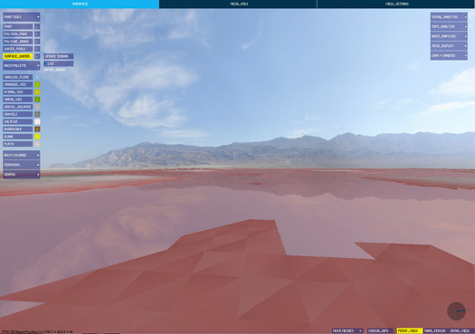
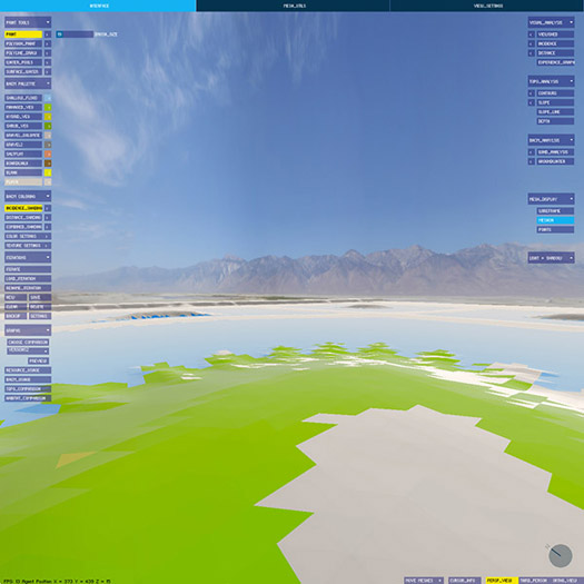
(This, I should note, is remarkably similar to how Alex Robinson explained the intentions and potential of the bespoke landscape visualization and analysis tool package he presented during the workshops we organized for DredgeFest Louisiana. Robinson has been developing that set of tools for a specific project, a collaboration with the Army Corps of Engineers at California’s dry Owens Lake; I immediately wanted to see the tools recontextualized as first steps towards a set of geographically-agnostic instruments, a first draft of a true landscape information modeling package.)
SoftwareSaltFlats

interface
[Screenshots from software produced for the Landscape Morphology Lab’s Rapid Landscape Prototyping Machine project.]

Having introduced the general pattern of Belesky’s work (hopefully without misrepresenting him), on to the primary subject of this post, Belesky’s recent post “Pruned Precedents and Growing Potentials”. That post (planned as the first in a series, all of which will be worth reading if this first instalment is any indication) reads Julian Raxworthy’s thesis, “Novelty in the Entropic Landscape: Landscape architecture, gardening, and change”, in light of Belesky’s own interest in the potential of computational design, refocused on “the temporality, uncertainty, and dynamism of landscape systems”.

I am now encouraging you to read the actual text of Belesky’s post. When you return, I’ll quickly say four things about Belesky’s reading of Raxworthy.

emergence
First, I’d like to record my strong agreement (along with Belesky) with Raxworthy’s critique of the products of the influence of the “Process Discourse” (as Raxworthy terms it) on architectural design. I’ll quote the same portion of Raxworthy that Belesky does:

This new disciplinary proximity is most evident in a fascination with change and time, expressed in terms such as “dynamism”, “mobility”, “process” and “flexibility” that have featured prominently in publishing in both areas since the mid-1990s. This body of thinking and practice I identify as the “Process Discourse”…

…The rise of the process discourse has seen the adoption of ecological models of process, and their generalisation into algorithms, which are now incorporated into architectural-design generation process in order to give designs some of the qualities of dynamism that natural systems possess. Architectural genres such as parametricism and datascape work to model dynamic landscape forces in the design-generation process, but do not change when made as actual structures in reality. I argue in this dissertation that by simulating change, projects underpinned/informed by the process discourse do not exhibit the key philosophical property of change, which is the spontaneous emergence of novelties. This property is recognised in the language used by the process discourse by terms such as “emergence”, but is effectively ignored in the simulatory models of architectural form.

That’s accurate and well-put. (I think I was groping towards a similar critique in the early days of mammoth, though I never arrived at anything nearly as elegant or systematic as Raxworthy’s critique.)
t_Edaphic02

9-Edaphic_Infiltration-Feature
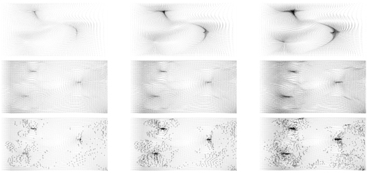
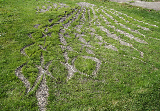
[Diagram and site photography from PEG Office of Landscape + Architecture’s “Edaphic Effects”, a gorgeously exact/inexact instance of site-specific “off-label uses for erosion control products”, to quote Sarah Cowles. “Exact/inexact” because it is both an instance of tightly controlled variation in pattern and an instance of the imprecision of the application necessitated by the execution of that pattern not just in material, but in landscape material. That inexactness is perhaps one of the most interesting differences between digital morphogenesis in landscape and most digital morphogenesis in architecture, and hopefully a space that future computational landscape architects will more fully exploit.]

pattern and process
As Belesky moves into outlining points where he diverges from Raxworthy, he makes a brief comment that I find illuminating when placed against arguments from Karen M’Closkey’s recent work on pattern and process. Discussing Raxworthy’s criticism of the tendency of the work like that of the AA’s Landscape Urbanism program to treat data and process as the generator of a logic for a new “short-term reconfiguration” of landscape that is “largely static and inflexible”, “impos[ing] a new equilibrium upon the landscape”, Belesky argues that digital simulation is nonetheless capable of contributing to a design process that admits “the slow and gradual trajectories of landscape systems”:

“…improving those tools to better take account for temporal processes would probably discourage a tabula rasa approach by helping designers to work with — rather than supersede — the systems present on-site.”

This helps me articulate a discomfort I had when reading M’Closkey’s recent contribution to JoLA, “Synthetic Patterns”. The article is generally excellent, and I am very much appreciative of the overall intention and results of M’Closkey’s efforts to recover a role for pattern-making in landscape architecture. (The core of M’Closkey’s argument is roughly that patterns have the potential to organize site processes while “bind[ing] together oppositional categories that seem to plague discussions in landscape architecture—system versus composition, representation versus performance, matter versus symbol, vision (distance) versus immersion (multi-sensory)”.) Unfortunately, M’Closkey ends the article in an excessively cautious way, associating the efficacy of the kind of digitally-generated pattern she argues for primarily with their capacity to organize post-industrial sites:

“To design with nature today, we should not attempt to camouflage the fact of our manufactured sites—sites that must be remade in order to support new uses and habitat. There is no inevitable form, or formula, for dealing with such sites, so we need not rely on standardized, engineered solutions for doing so.”1

1I should note that I am reading M’Closkey’s text in parallel with the video from her presentation at the recent Datascapes symposium at LSU, where she makes this point at least as explicitly.

2That said, I think this precise opposition is present in this neat formulation only in M’Closkey’s rhetoric, which suggests that it is possible I am making too much of it. In her built work, like the “Edaphic Effects” project shown above, pattern serves to mediate between extant systems and the designer’s intent, as evidenced by the use of “parametric software to visualize existing and redirected water flow patterns”.

I find this an unfortunate turn both because it elides the value and utility of the natures already present on such sites and (this is where I think Belesky’s point is useful) because it radically limits the scope of the argument for pattern that M’Closkey is making. It seems to me that the promise of digital pattern-making is instead the opportunity to move beyond the kind of relatively simplistic patterns that analog pattern-making at the scale of the capital project is confined to (e.g. the Peter Walker projects M’Closkey references in the article) and, instead, toward more sophisticated pattern-making techniques with rulesets that take into account simulations of the interactions of pattern and process. This would, as Belesky argues, “discourage a tabula rasa approach by helping designers to work with… the systems present on-site”. Viewed in that light, hinging an argument for the role of pattern on the explicit selection of ‘blank’ landscape canvases seems precisely the opposite of the best rhetorical and operational strategies2.

on the limits of simulation
Responding to Belesky on his own blog, Raxworthy reiterates his argument:

“In terms of argument, I acknowledge his points completely in clarifying what simulations can do, and particularly his gentle reproach that there is more recent work from Penn that are better simulations: what can I say, I wrote that part of the thesis 10 years ago, and kept it, because the basic argument remains true that simulating growth and real growth are different. While it may be interesting and worthy to pursue more accurate and effective models of simulation, their focus will always be on their own internal complexity and growth. Which is fine if your site is the interior digital milieu. But if it’s the world, then I argue (a bit polemically here, I grant, but it’s the nature of my blog) you are chasing your tail, since modeling will always by definition lag behind the real.”

In general, I think I’m agnostic about the implications of the truth (or truism, which is the issue) that Raxworthy notes: yes, simulations by definition are incomplete models of the real; but this hardly answers the question of whether they are a useful tool for making landscapes in specific instances. If forced to venture a response, I would be probably offer something like: sometimes they are very useful and other times they are worrisomely misleading or unpredictably wrong, with the skill lying in the negotiation between and evaluation of those two possibilities. Consequently, I’m attracted to schematics for that negotiation, like this from Jamie Vanucchi’s landscape modeling studio tumblr.

Similarly, I’m also in complete agreement with Brian Davis’s argument for a multifaceted approach to landscape information modeling in his “Landscapes and Instruments”:

“[Arguments for the inclusion of landscape components in BIM software platforms are compelling] but ignore a set of important issues related to landscape practice that spring from the realization that architecture and landscape are different mediums. While sharing many concepts, materials, working methodologies, and histories, there is no reason to suggest that our representational, investigative, and project delivery tools should be the same, or should have more in common than do landscape architecture and forestry, or sedimentary geology. In fact, I believe my work provides evidence to the contrary. Initial results thus far point away from trying to find a single computational environment for landscape representation, especially one built on the conceit of abstract, limitless space. Instead, it is the process of working between modes- comparing them, interrogating the assumptions and limitations of each- that has been most useful and revelatory in my work. This suggests that in addition to lobbying for the inclusion of landscape as a subset in the development of BIM technology, we should be learning from, appropriating, and synthesizing the representational models of ecologists, civil engineers, and sedimentary geologists to construct methods of landscape information modeling.”

tendency, feedback, and responsive landscapes
Ultimately, Raxworthy’s thesis arrives at a two-pronged response to the question of how landscape architecture can encourage and manipulate the emergence of genuine novelty. The first prong is “tendency”, which Raxworthy defines as “a way of thinking about the design process that recognises that design is a form-making process inherently tied to a prediction of an end, or later state, but where novelty is encouraged to develop over time”. The second is feedback, or “continuing, real-time involvement in a process … when the output of the process is fed back into another iteration of the process as an input”, which Raxworthy rightly associates with the role of the gardener. (One reason that I enjoy Raxworthy’s work is that I see gardening as one of the key disciplinary inheritances of landscape architecture, and appreciate seeing it explored in a non-reactionary context.)

3I think this is also roughly what I mean above when discussing pattern and process.

Reacting to these two prongs, Belesky focuses on the first, tendency, arguing that “the use of computation to examine ‘tendencies’ in the design process seems promising”. This makes sense, as this is precisely what his earlier article in Kerb suggested needs to be happen3.
1801376_576812662402408_2045703302_o

1557299_576812609069080_1239894891_o

1913328_576812659069075_103836812_o
[Images from “strATA”, a proposal to use “remote environmental sensing and large-scale climate models” to “build a feedback loop of sensing, reacting, and adaptation” toward designed incremental sedimentary deposition. “strATA” was produced by Lydia Gikas and Matt Rossbach in Bradley Cantrell and Justine Holzman’s Fall 2013 studio at LSU.]

However, I think his quick concession that the second prong is not a promising direction for digital landscape architecture is, in fact, far too quick:

“Unless environmental sensors become widespread and embedded, there isn’t much opportunity for computational tools to engage with real-time feedback.”

Doesn’t the opening conditional here at least have a strong likelihood of being false in the near-future? Sensors are cheap, getting cheaper, and being deployed in a wide variety of environmental uses that read like science fiction: sedimentary particle trackers, autonomous underwater monitoring robot swarms, Plants employed as SEnsing Devices, the overlap of remote sensing and virtual fencing. Rather than “not much opportunity”, this seems an extremely promising field of study, if technologically volatile. (Bradley Cantrell‘s work is one obvious example of such exploration.)

Now let’s all go read Orrin Pilkey’s Useless Arithmetic while doing exercises from The Nature of Code.
mesosphere excavations

Govedare_Melt

Excavation-5

Mesosphere

Excavation-6
[Four recent atmospheric paintings of abstracted anthropogenic geomorphologies by Philip Govedare, whose work was recently featured on Butdoesitfloat. In order from top to bottom, the paintings are: “Melt”, “Excavation #5”, “Mesosphere”, and “Excavation #6”.]

semipile

FFM_1

FFM_2

FFM_3

FFM_4

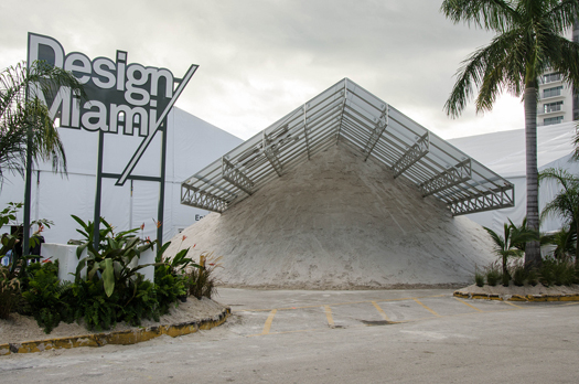
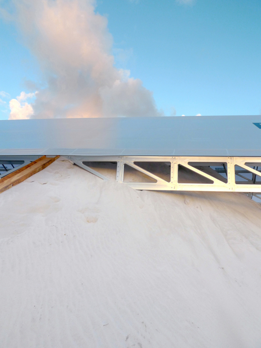
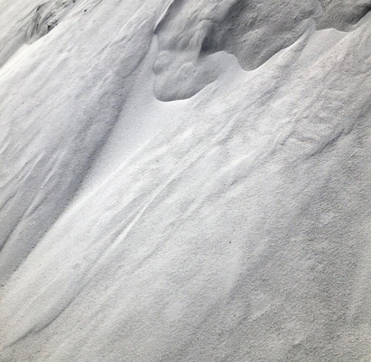
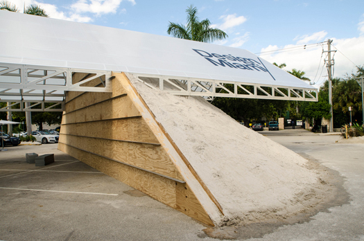
[As a Friday return to blogging for mammoth, photographs of Formlessfinder‘s lovely half-pile under cantilevered canopy at Design Miami, December 2013. You can watch the architects talk about the design and construction of the pile over an exceptionally annoying soundtrack here.
More architecture via material deformation, please.

The photographs are, in order from top to bottom, by Flickr user Dave Pinter, Formlessfinder, Formlessfinder, and Dave Pinter again.]

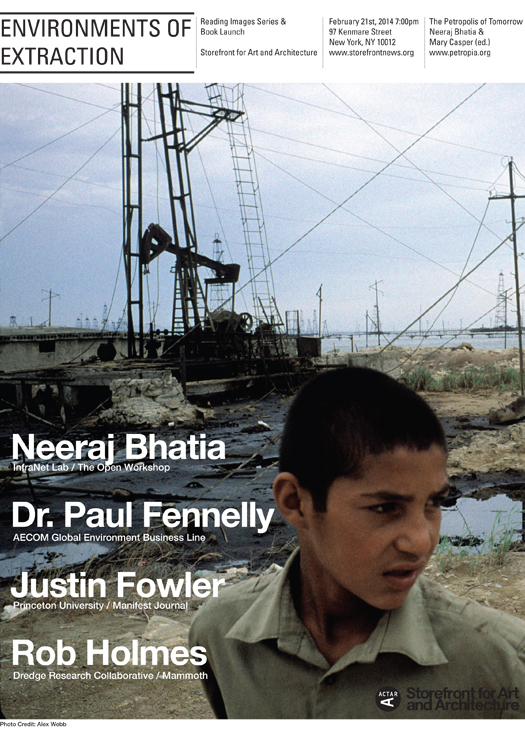
environments of extraction

Poster_Storefront

I’ll be at the Storefront for Art and Architecture in New York this Friday evening, speaking on a panel about “Environments of Extraction”:

Resource extraction and urbanism have always had an intimate love/hate relationship. In the past fifty years, we have witnessed this relationship yield a series of global infrastructures and cities that are increasingly impacting and influencing all aspects of the globe. As these infrastructures, landscapes and territories become inadvertently integrated into the contemporary city, how can they be reconceived to address issues of urbanism that sit outside the logistics of resource extraction? During this panel discussion, we will examine the role of resource extraction on urbanism and question how design can hybridize these infrastructures with the competing forces of economics, geopolitics, cultural values, and ecologies.

The panel is part of the launch tour for Neeraj Bhatia and Mary Casper’s recent book, The Petropolis of Tomorrow, which “speculates on new methodologies for integrating infrastructure, landscape, urbanism and architecture within the larger spheres of economics, politics, and culture that implicate these disciplines”. The event should kick off around 7 pm this Friday (21 Feb) and is open to the public; Storefront is located at 97 Kenmare Street.

[You can follow the general progress of the Petropolis of Tomorrow research project through its research website and blog.]

glitches, flash crashes, and very bad futurists

Last fall, Vincent deBritto and Ozayr Saloojee invited me to come visit their Resilient Infrastructures project at the University of Minnesota; my main contribution was to deliver the lecture above, “Glitches, Flash Crashes, and Very Bad Futurists”. The lecture examines a particular class of landscape problem, which I’ve provisionally described as “glitches and flash crashes”, argues that this kind of problem reveals a potentially (literally) disastrous flaw in the project of distributed design, and concludes by recommending that architects and landscape architects draw on the tools and methodologies of the discipline of futurism to become better futurists. This brings together and expands on a pair of concepts that I began to develop in earlier posts on mammoth, “very bad futurists” and “unknown unknowns”.

Here’s my full description of the talk:

In the mid-nineteenth century, British geologist Charles Lyell travelled through the antebellum American South; what he found shocked him: forest-clearing, shoddy farming practices, and rainwater had worked together across broad swathes of the South to gouge vast and deep gullies that had no apparent geologic precedent.

This extremely rapid change—it took only a few years for millennia of accumulated soil to completely erode, leaving wounds that gaped often fifty, sixty, even eighty feet deep—might be understood as an example of how landscapes are prone to rapid perversion through the aggregate impact of many actors (in this case, farmers) behaving in accordance with misaligned incentives (in this case, a system of tenantry that favored exhausting plot after plot over developing sustainable practices for a single plot). Collectively, these tendencies both present difficulties for the design of resilient human settlements and suggest the need for designers to become better and more rigorous futurists.

north coast design competition

dredge-city_1
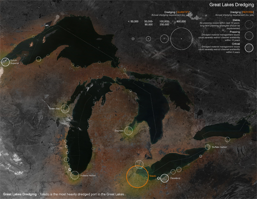
[Map of annual dredging volumes in American cities in the Great Lakes Basin, via Matthew Moffitt’s project “Dredge City”, which won the 2013 ASLA Student Award of Excellence in General Design.]

The city of Toledo is the epicenter of dredging on the Great Lakes: of the roughly three million cubic yards of material dredged in the Great Lakes every year, nearly a full third is sucked out of the Maumee Bay and deposited in disposal areas in and around Toledo.

This rapidly-accumulating surplus is the focus of the first North Coast Design Competition, initiated by fellow dredge fanatic Sean Burkholder. Entitled “Designing Dredge: Re-envisioning the Toledo Riverfront”, the 2014 edition of the competition offers an opportunity to explore the collision of dredged material management and large-scale public space on an urban riverfront, with the specific charge of creating a “dredge research” site, which would host activities like “de-watering experiments, plant growth studies and admixing operations” while “prioritiz[ing] the relationship between dredge material and the public”. (Which I find considerably more exciting than the perhaps more obvious suggestion that landscape architects make a few more parks.) Burkholder recently spoke with Landscape Architecture Magazine‘s Jennifer Reut about the reasoning behind the launch of the competition:

You’ve put the use of dredged material and dredge research sites at the center of the competition’s program. Why?
Dredging in particular is something that does occur in the entire basin, and that’s increasing because of water level recession in the lakes. Shipping is the most cost-effective means of transport in the area, and it continues to be a better option for moving bulk materials. Shipping is not going anywhere, so dredging is not going anywhere. It’s an inevitable condition that needs to be addressed.

Toledo is in the shallowest portion of the Great Lakes. Because of that, the shipping channel in Toledo is 20-plus miles long, so imagine what an incredible amount of material that is. The only way of getting ships into the port is continuous dredge… Right now, a dredge research site doesn’t exist. In order to be useful, the material needs to be tested and evaluated, and we need to experiment to see what we can actually do with it. There’s so much of it in Toledo, it makes sense for the experimentation to occur there.

Additional details about the competition, including schedule, requirements, background materials, and jury, can be found on the competition website. Registration opens February 1 and ultimately closes March 30.

[Jennifer Reut also recently interviewed Matthew Moffitt, whose drawing headlines this post, about his project “Dredge City”. Burkholder was Moffitt’s advisor for the project.]

sediment and wind

sediment-wind
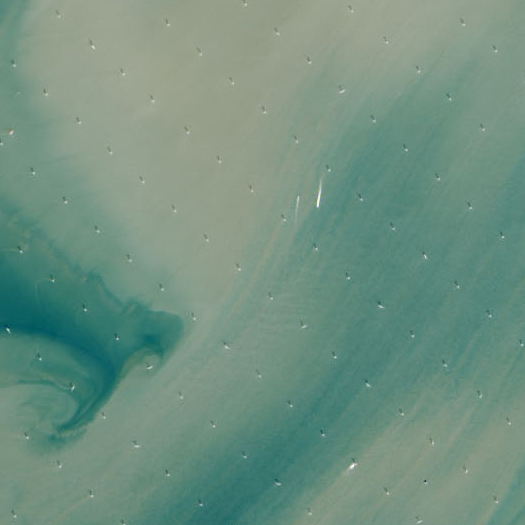
[The even grid of the world’s largest offshore wind farm, the London Array, surrounded by swirling sediment in the Thames Estuary. Seen at NASA Earth Observatory:

To date, the London Array includes 175 wind turbines aligned to the prevailing southwest wind and spread out across 100 square kilometers (40 square miles). Each turbine stands 650 to 1,200 meters apart (2,100 to 3,900 feet) and 147 meters (482 feet) tall. Each is connected by cables buried in the seafloor, and power is transmitted to two substations offshore and to an onshore station at Cleve Hill.

With construction operations working out of Ramsgate, the Array is eventually supposed to grow to 245 square kilometers (95 square miles). The wind farm sits on two natural sandbanks, with water as deep as 25 meters (80 feet). The site was chosen because of its proximity to onshore electric power infrastructure and because it stays out of the main shipping lanes through the area.

Via Tim Maly.]

land-making machines

audubon-dredge-at-rainey
[The Audubon Society’s micro-dredger, the John James, making new land in the Paul J. Rainey Wildlife Sanctuary in South Louisiana. Karen Westphal, Audubon’s Atchafalaya Basin program manager, will be speaking about this participatory micro-dredging project at DredgeFest Louisiana’s symposium, which is this Saturday and Sunday at Loyola University in New Orleans.]

Tim Maly and I explain why we’re holding DredgeFest in Louisiana this coming weekend (and following week) for Gizmodo:

…south Louisiana is disappearing—terrifyingly fast. Sea-level rise, salt water intrusion, and canal excavation for industrial purposes have all combined with the constrainment of the river via flood control infrastructures to radically alter the balance between deposition, subsidence, and erosion. Instead of growing, the delta is now shrinking. Louisiana has lost over 1700 square miles of land (an area greater than the state of Rhode Island) since 1930. Without a change in course, it is anticipated to double that loss in the next fifty years. By 2100, subsidence, erosion, and sea level rise are projected to combine to leave New Orleans little more than an island fortress, effectively isolated in the rising Gulf of Mexico.

Moreover, even where the land itself may not be entirely submerged, the loss of barrier islands and coastal marshes exposes human settlements ever more precariously to the vicious effects of hurricanes and tropical storms, including the destructive waves known as storm surge.

This situation is entirely untenable. You thought Katrina was a terrible disaster? (It was.) Imagine what happens to New Orleans when a Category 6 hurricane hits in 2086, when even the highest ground in the French Quarter and the Garden District is barely above sea level and well below the ever-thickening barriers the Army Corps will throw up to protect America’s newest island.

In response to this apocalyptic but plausible threat, Louisiana is engaging in the world’s first large-scale experiment in restoration sedimentology. With the aid of components of the federal government like the Army Corps of Engineers and a bounty of funds earmarked for coastal restoration and protection as a result of payments owed by BP for the damages wrought by the 2010 Deep Horizon oil disaster, Louisiana has accelerated its nascent crash-program in experimental land-making machines, rapidly prototyping a wide array of weird and wonderful techno-infrastructural strategies for building land. This is an effort to cobble together a synthetic analog to the land-making machine that the Mississippi once was. If you want to understand the future of coastlines and deltas in a world of rising seas and surging storms, you should pay close attention to what is happening in Louisiana.

Read the full piece at Gizmodo. (And, if you’re able, come to DredgeFest Louisiana!)